
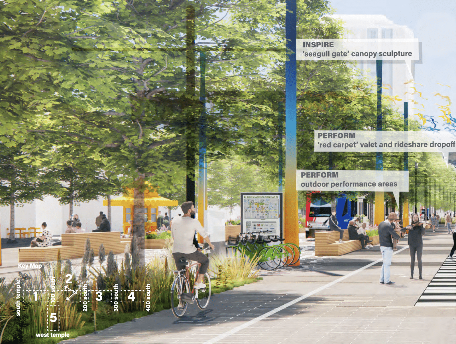
Under the surface of Spokane Falls Boulevard lie 125-year-old water lines in dire need of replacing. The project will require tearing up the street and sidewalk, which the city sees as an opportunity to rethink the experience of Spokane Falls Boulevard at the street level.
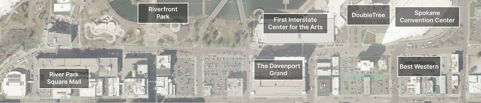
The project runs just over a half mile, from Lincoln Street on the west side to Division Street on the east. This stretch is a major downtown destination for both locals and visitors, positioning it as a corridor of enormous economic value: it links the Spokane Convention Center, the First Interstate Center for the Arts, three hotels (including The Davenport Grand), River Park Square, bars and restaurants and downtown’s crown jewel Riverfront Park.
Along that route, there’s a lot of room to get creative. The right-of-way (the land the city owns, street and sidewalk included) along Spokane Falls Boulevard is over 90 feet wide.
Right now, Spokane Falls Boulevard is not living up to its potential.
There have been at least 90 collisions on this stretch within the last 10 years. Of those, eight people on foot — all in a crosswalk — and one person on a bike were hit by people driving cars.
Thankfully, engineers on the project have some ideas for improving it (I’ll walk you through them below) and you can share your opinion on the redesign options here.
Protected lanes for those on wheels
In early concepts for the redesign, protected bike lanes run westbound for the full length, but eastbound only from Washington Street to Division Street, leaving a break in connectivity for cyclists, which presents a problem.
Jeff Sevela, who regularly uses his bike to get around, hopes the final concept will plan for the eastbound bike lane starting at Howard Street, which is a major north-south route for folks on bikes — one of the only bicycle-friendly routes over the river.
“By not starting the eastbound bike lane at Howard [Street], one of the core requirements of a good bicycle network is violated, that of continuity of connecting to other bicycle routes,” Sevela said in an emailed statement to me.
These lanes aren’t just for lycra-wearing athletes or that stereotypical “avid cyclist” — they’re for the commuters and the old folks on e-bikes and kids on bikes with training wheels, they entice scooter riders off sidewalks and are shown to make streets safer for all users (including those on foot and in cars).
National research revealed that over 50% of metro residents are interested in using a bike for some trips, but choose not to ride due to safety concerns. By addressing those safety concerns with things like protected lanes, there would likely be measurable increases in usage.
Even for those who do not bicycle and never plan to, there is a benefit to all — more people using other modes of transport means less traffic congestion for drivers on the road.
Converting Washington to Division back to two-way vehicle traffic
Currently, Spokane Falls Blvd. is a one-way street along its entire length west of Division. Converting the portion between Washington and Division back to two-way traffic could provide easier access for those driving to the Convention Center and First Interstate Center for the Arts from the south or west. It may be unintuitive, but two-way streets have been shown to be safer than one-ways.
Travel lanes replaced with parking spots
Don’t worry folks, some early concepts include additional curb parking spots, so don’t come at me about losing parking. There are also three parking garages (at the mall, at the Convention Center, and at The Grand) and three large surface lots along Spokane Falls Boulevard, so there is plenty of parking in the area**.
Engineers who attended a Bicycle Advisory Board meeting assured me that lane replacement will have no impact on congestion – meaning the boulevard as it is now is wider than necessary. During a budget crisis like the one we’re now, maintaining (repairing, plowing, striping, sweeping) more street square footage than we need could be costly.
And — you guessed it —reallocating lane space also makes the street safer for all users.
**A 2019 parking study of downtown Spokane found that “Even during the busiest time of day… parking occupancy across the study area peaks at 56%. At peak, thousands of parking spaces are underutilized.” That percentage is most likely even lower now, as downtowns across America struggle to recover to pre-pandemic levels.
A better walk in the park
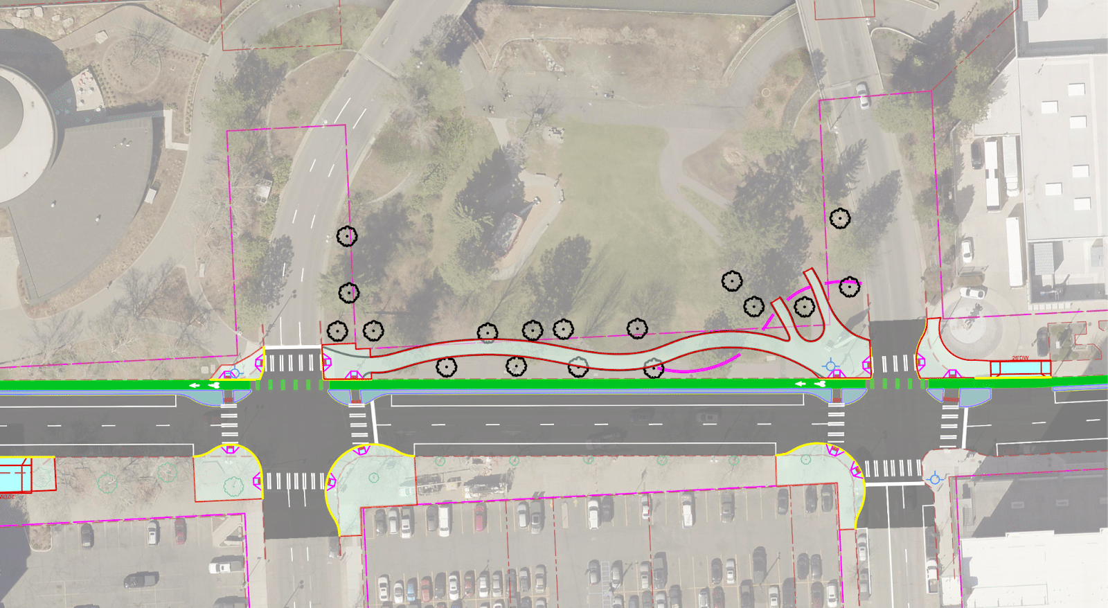
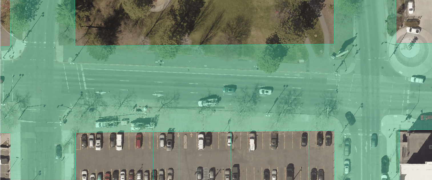
This early concept shows an improved walking path within Riverfront Park running parallel to Spokane Falls Boulevard between Stevens and Washington, so pedestrians looking for a stroll in the park will have an easier time getting there.
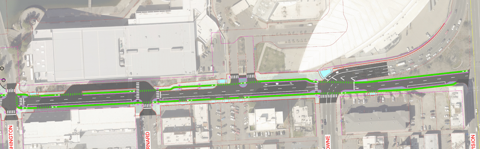
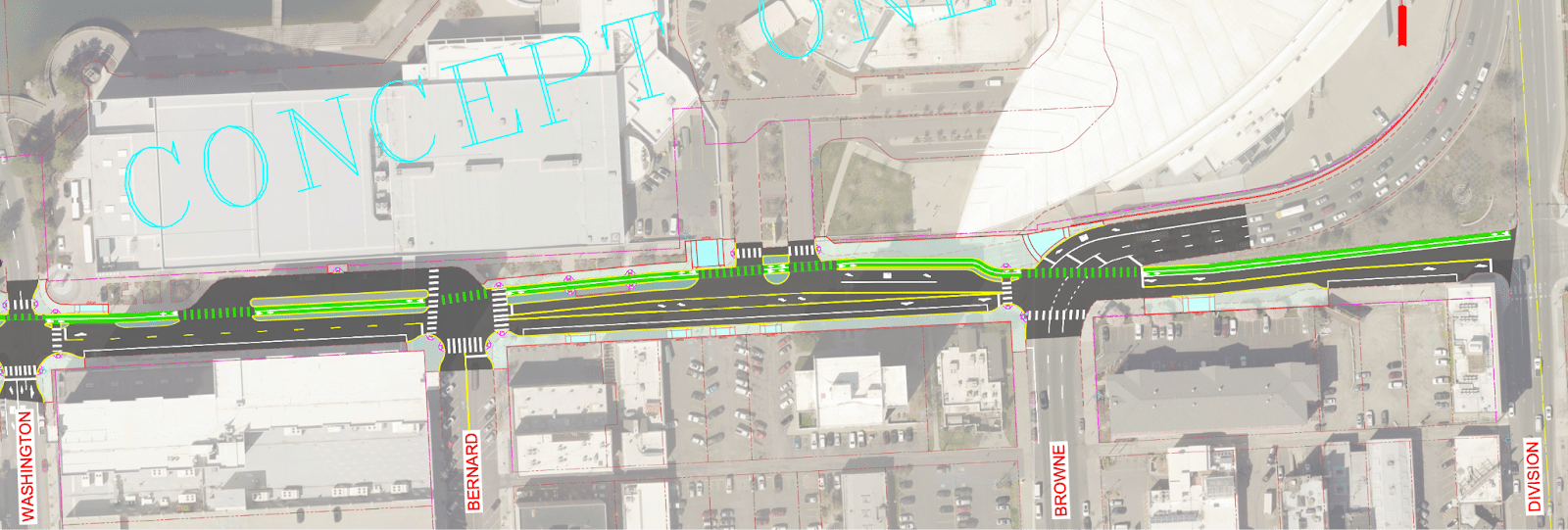
Simpler intersection where southbound Division curves into downtown
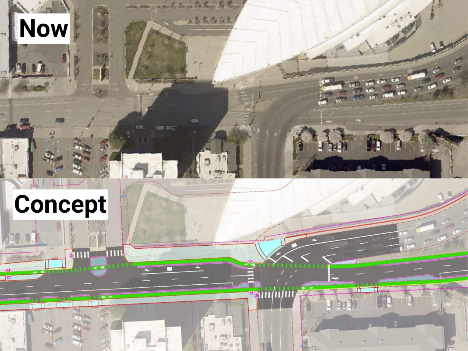
This early concept shows a simplified intersection that removes the awkward merge in front of the convention center — one that is especially unclear and difficult to navigate on a bike.
Simplicity means it’s easier to know what to expect from all road users.
Return the space to the people
The proposed changes are a start to a more pedestrian-friendly Spokane Falls Boulevard, but some have an even more ambitious vision of the future of the street.
Last summer, Erik Lowe was crossing Spokane Falls Boulevard in a crosswalk at Post Street when he was nearly struck by an SUV speeding through a red light. He sees the redesign as an opportunity to transform the road from merely a way to get where you’re going to a place people can enjoy using to hang out, eat and enjoy art.
“This should include protected bike lanes, parklets and expanded outdoor seating for the restaurants along the boulevard,” Lowe said.
He also believes street safety is a crucial ingredient to bringing people into the space and thinks the city should “place speed tables at regular intervals to encourage safe speeds and local traffic only.”
The changes Lowe espouses sound a bit like the Dutch concept Woonerf, or living street, where all users (including those in vehicles) coexist.
Lowe is not alone in his hopes for the area — he founded a group of advocates called Spokane Reimagined who are continually pushing the region for better transit, safer streets and more consideration for pedestrians and bicyclists in all levels of city planning.
Some inspiration, perhaps
The city will be designing throughout 2024 and 2025 and construction isn’t expected to start until between 2026 and 2028. Though right now, the city is accepting your feedback on this project via this super easy three-question form, but you can add comments if you feel especially passionate. To get you started, I’ve compiled some more inspiration on how the city could use this project to refresh a key economic downtown corridor, looking to other North American cities who are making headway in these kinds of redesigns.
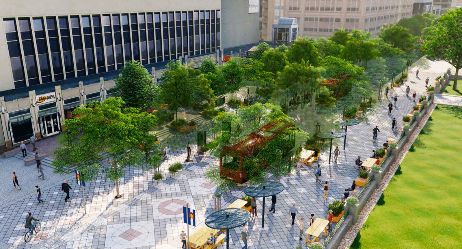
Salt Lake City’s Main Street Promenade
This section of Salt Lake City’s Main Street is similar to Spokane Falls Boulevard: it has aging utility lines and connects popular downtown destinations, including a large modern mall, a religious center, an outdoor concert venue/ice rink, a convention center and two performing arts centers.
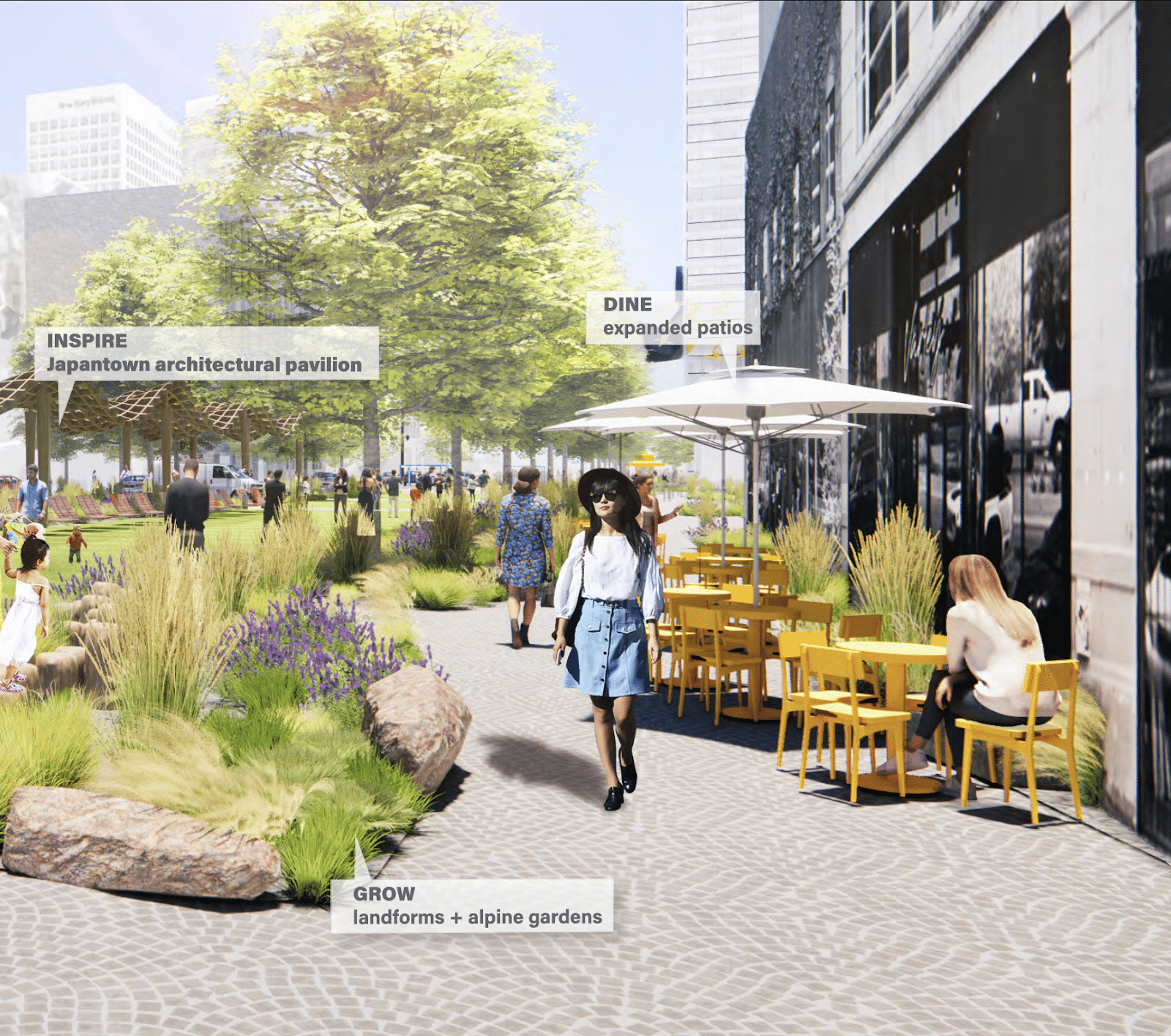
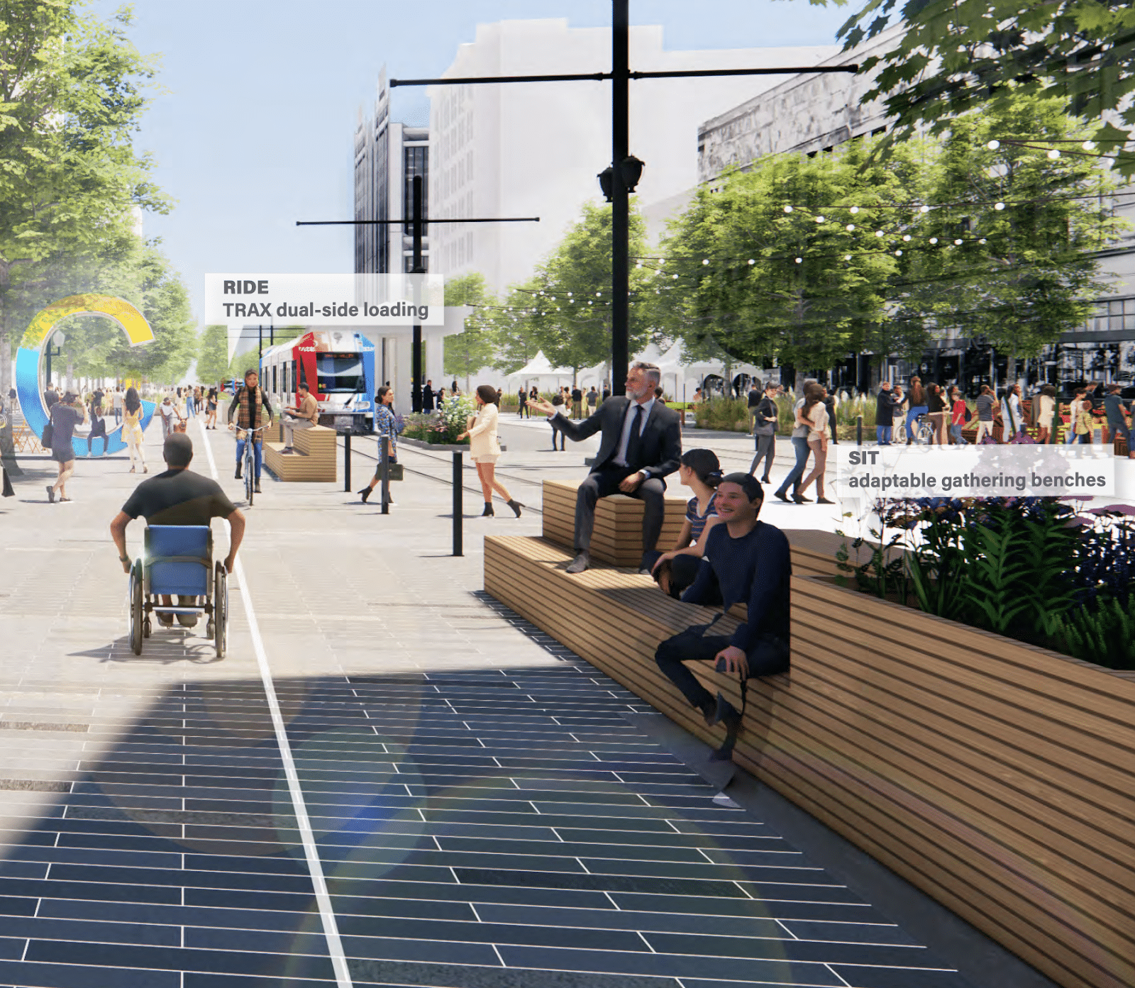
Early concepts show these additions within the right-of-way: restaurant patio seating, immersive public art installations, outdoor lounge and work areas, gardens to gather in, overhead canopy structures, plazas with fireplaces, 285 new trees to cool and shade the area and plentiful space to safely ride and walk. At a vibe level, it feels like a place people will want to gather, not just a place vehicles pass through.
Interestingly, this project is not led by the planning or public works departments, but by the city’s Department of Economic Development — pointing to the significant economic value created by such projects. Salt Lake experimented with pedestrian-only Fridays and Saturdays on Main Street during 2022, which caused spikes in restaurant sales that exceeded pre-pandemic levels, which has been tough as downtowns seek to recover from the pandemic.
Denver’s 16th Street Mall
The 16th Street Mall has been a rousing success as a destination for both tourists and Denver residents due to its design: it has seating, arts, lights and greenery. It even features a free bus that travels up and down the corridor.
The Downtown Denver Partnership, an association of business owners, describes the one-mile stretch as an “economic engine”: it generates over 40% of the city’s total downtown tax revenue, bringing in approximately $75 million/year (2020).
The original redesign of 16th Street in the ‘70s was prompted by its business owners. And it is currently being remodeled again to make it even more people-friendly, adding more trees, more street furniture and play structures for kids.
Banff’s Bear Street
Bear Street in Banff, Canada is a pleasant place to walk and enjoy a coffee and a pastry. It uses planters, trees, benches, bike parking and even trash cans to lower speeds and protect pedestrians.
Spokane’s Wall Street
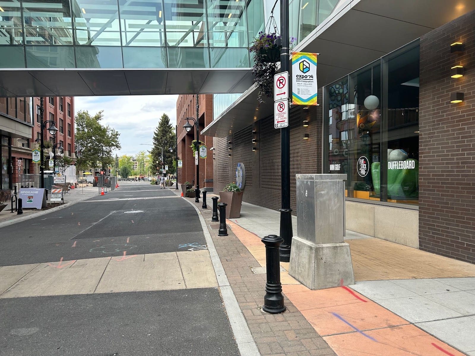
Photo of the pedestrian-friendly section of Wall Street by Lauren Pangborn.
Perhaps not a key economic corridor, but Wall Street (from Riverside to Spokane Falls) has elements that make it pedestrian-friendly: it is curbless, curvy, shaded, and utilizes bollards to protect from straying cars. The city already knows how to make space inviting.
Such projects create a sense of place and community, bring people downtown, drive revenue for businesses and increase property values. The Downtown Spokane Partnership champions Crime Prevention Through Environmental Design, which includes the idea that less crime will occur where the environmental design has attracted numbers of people having positive social interactions.


